In the summer, Old Mission is usually a no-go zone for me unless visitors come to town. M-37 is really the only way to get around quickly, and during the summer, there are too many cars looking at too much beautiful scenery to get anywhere quickly. Add to that Traverse City’s infestation of Subaru Outbacks, the slowest car on the road, and it’s a frustrating ride.
Next year will be even worse, with the construction on Grandview Parkway coming next month, getting to the east side of town from my home on Leelanau will be a painful process, one not worth taking unless necessary. Sorry Jimmy John’s, my visits will be falling off quite a bit until the fall.
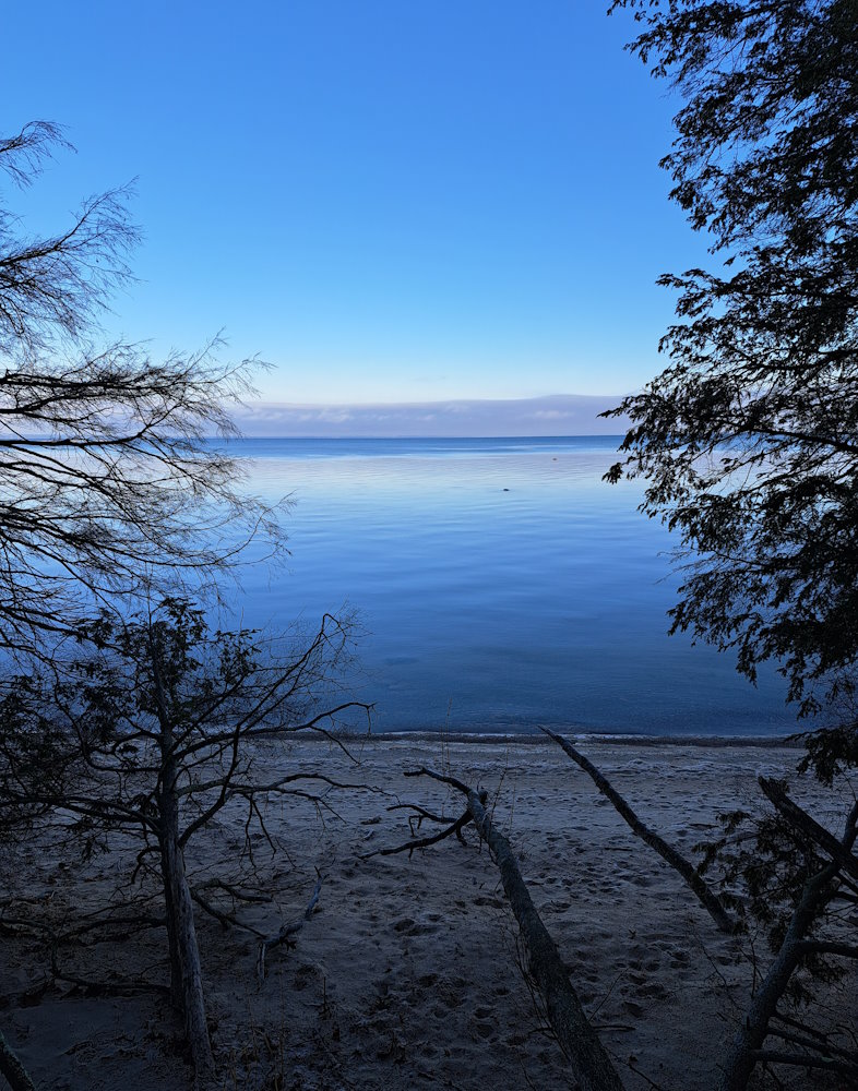
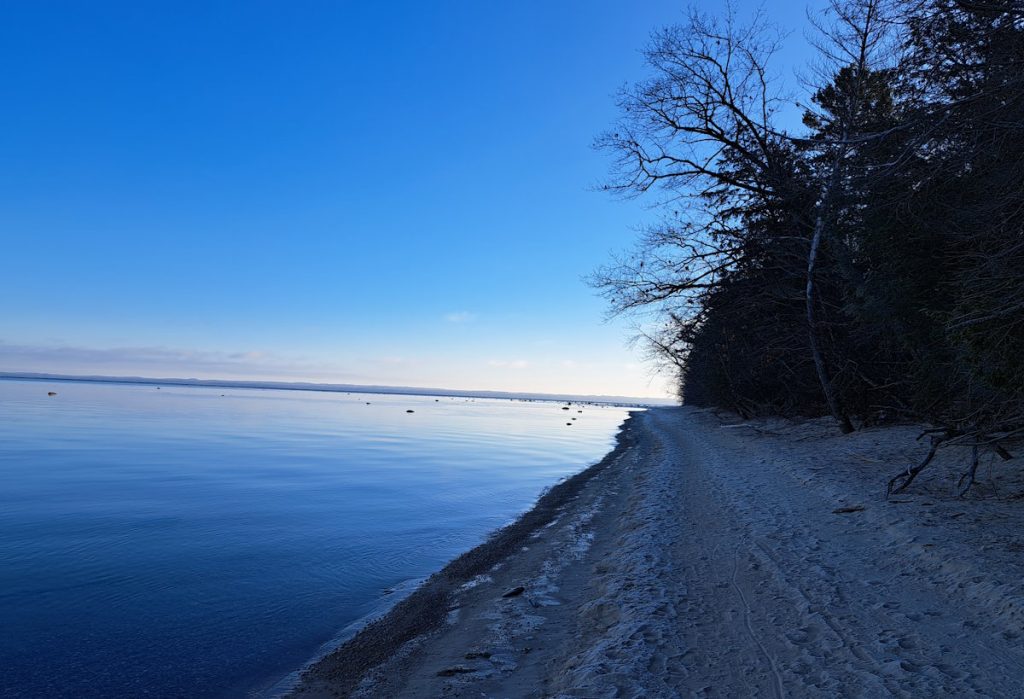
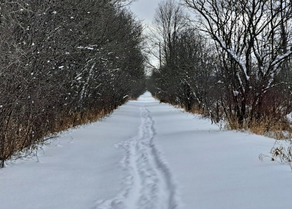
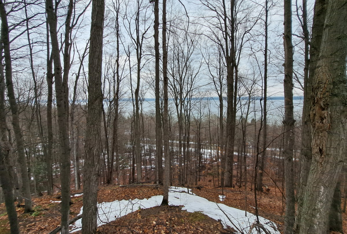
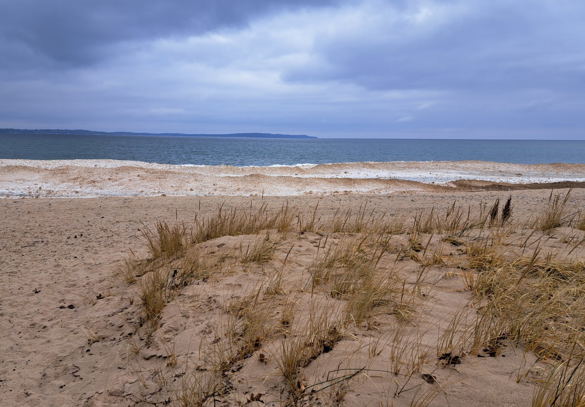
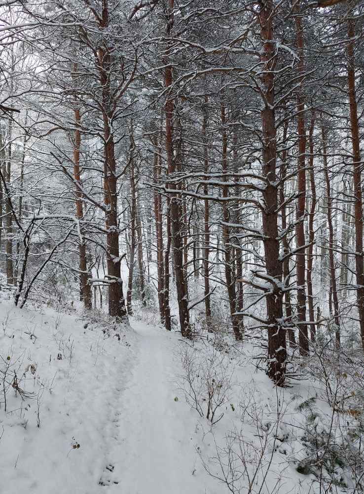
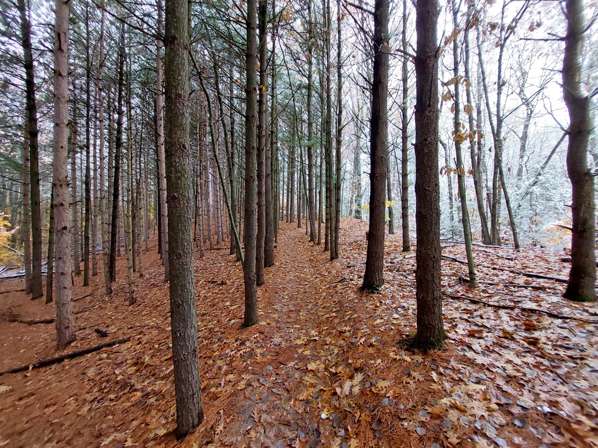
But during the off season, especially in the morning, it’s not a bad ride, and it’s not too difficult to zip around the slow drivers to get to the tip of the peninsula. My mission was the Old Mission State Park where I did a long hike. This time of year, the trails aren’t attractive – brown is the main color, with leafless trees, muddy trails and dead grasses.
The real draw is the water. While the path doesn’t follow the water the whole way, there are a few nice views along the way.
My day started with high hopes. Adam, whom Andrea and I talked to over beer, nachos and cheesy bread at Short’s in Bellaire the night before, had suggested the Jordan Valley Pathway about 30 minutes north of Bellaire. Andrea was going to be at her medical conference all day, and his suggestion sounded better than the one I had planned. I considered this a fortuitous conversation.
I do recommend Short’s if you are looking for some good food and excellent beer around Bellaire. The nachos were good (not as good as mine, if I do say so myself, and I do) and the cheesy bread was excellent. The highlight of the evening was the Cone Thugz stout, an outstanding dark beer made with, among other things, waffle cones. This is right up there El Mexigander at Loco Boys as my favorite beer of the moment. The enjoyment was not derailed by the fact that we were sitting next to the door which opened and closed all night, a night where the temperature dropped to -7.
Back to hiking. Things went off the rails before I reached the trail. Turning off US-131 onto Deadman’s Hill Road, all went well until I reached the intersection of Edward’s Road a quarter mile before the parking area. At this point, a sign on Deadman’s Hill Road said that beyond that point, there would be no more plowing. Well, I thought, I have an all-wheel drive SUV, and the snow looked flat ahead. No problem.
Problem.
The road looked as solid as the part I had just driven over, but was actually 9″ of partially hardened snow that my tires easily sunk in to. So in less than 100 feet, my SUV stopped dead. After several minutes of back and forth, I was able to rock my way out and back onto the plowed section of road. Had I remembered to pack my snowshoes, I could have just parked on the side and walked the rest of the way. Regrets, I’ve had a few…
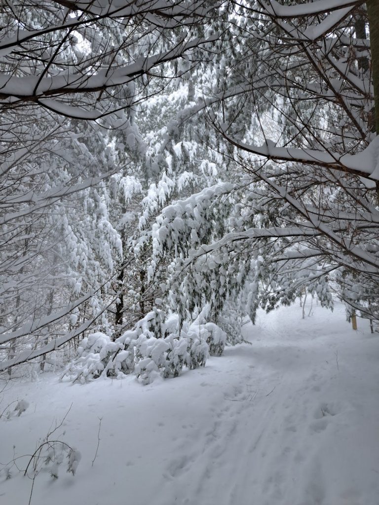
My morning plans shattered, I headed up to East Jordan to regroup. My options were a bit narrow because of said lack of snowshoes – the area had gotten around 18″ of snow over the past week. Snowshoes are now on my “Bellaire in the winter” packing list.
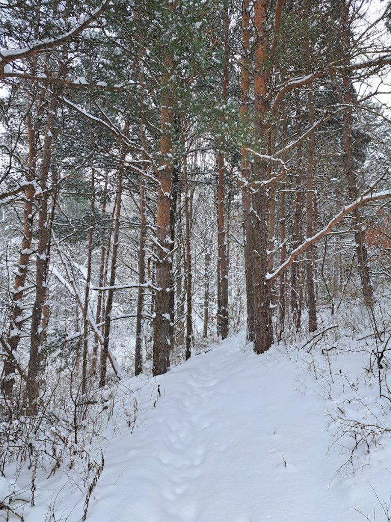
I settled on Brown’s Creek Pathway. I had hiked part of this trail before and hadn’t been terribly impressed, but I gave it another shot, treading on a new-to-me section of the trail. Luckily, someone had snowshoed earlier and made my walk a bit easier. The Red trail is actually a mountain biking trail which wove here and there, up and down, taking a long way to get not very far. And as I was halfway through the trail, my snowshoe hero had decided to stop and go back. I did the same. With so much snow, having never hiked this trail, I would have easily lost it.
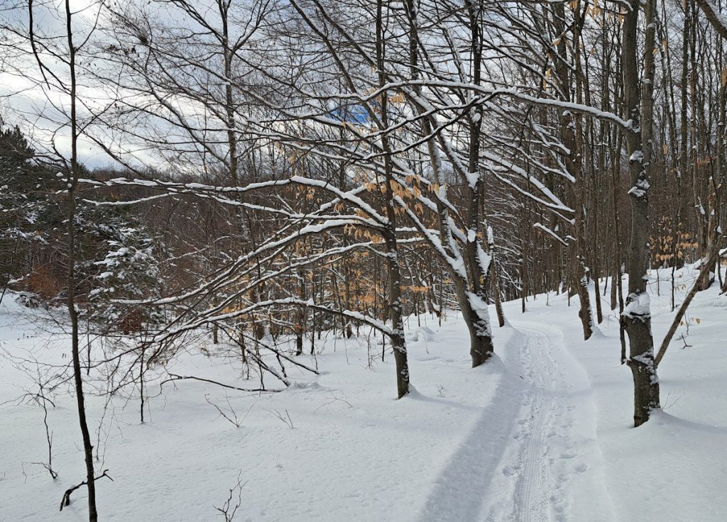
I had expected to spend quite a while on the Jordan Valley Pathway, so I looked for another trail nearby over a Quarter Pounder meal and found the Rogers Family Homestead Nature Preserve. This was an out-and-back trail paralleled the Jordan River. It was not broken down as much as the day’s previous hike and the going was a bit harder. If you look closely at the image below, you’ll spot the deer that crossed in front of me.
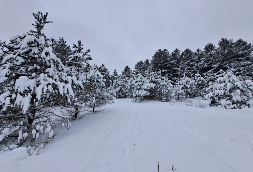
I had enough gas in my tank for one more hike. Needing to return to Bellaire to get Andrea from her conference, I stopped at Glacier Hills. I should have skipped Rogers and gone right here. This is primarily a mountain / fat tire bike course, and the trails were packed down nicely. It made for the day’s easiest walk, so if you are looking for winter hiking around Bellaire and lack snowshoes, I definitely suggest Glacier Hills.
After picking Andrea up from her conference, we headed to Elk Rapids where we had drinks at Ethanology, one of those fancy-drink places. They distill their own spirits and we each did a tasting followed by an adult beverage. It had an interesting steampunk vibe inside – I didn’t expect that in Elk Rapids.
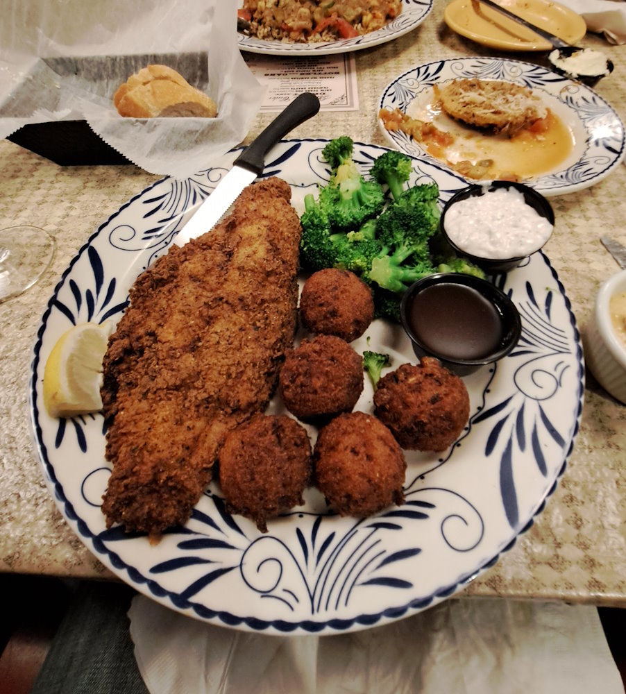
Just down the road in Pearl’s, the only Cajun restaurant in the area, and well worth the trip from TC. My first experience at Pearl’s didn’t go well – I was quickly sick after having a catfish po’boy. But that was in 2002 or so, and I have been a few times since and all has been well. Tonight’s meal was the corn fried catfish, which was excellent, as were the hush puppies and drinks. Service was spot-on and how can you not enjoy the hundreds of hot sauces lining the walls?
So just another dining, drink and hiking extravaganza weekend here Up North.
It was quite a weekend up here in Traverse City. We got about 17 inches of snow where I live on the Leelanau Peninsula over the weekend, causing me to have one of those rare days where I don’t leave the house.
That was Saturday. On Sunday, it was back out on the trails. After a sermon at Bayview Church, I headed over to Hickory Meadows for a hike in the snow. There were a surprising number of people out. The trails were by no means full, but the skiers were happy to be on the groomed trails. Me – I stuck to the woods.
I hope you all had a happy New Year’s Eve and Day. At the Stoecker house, we started our year with bubbly wine from Bel Lago and many, many snacks along with sushi from Fuji.
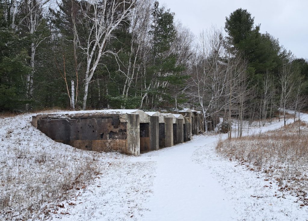
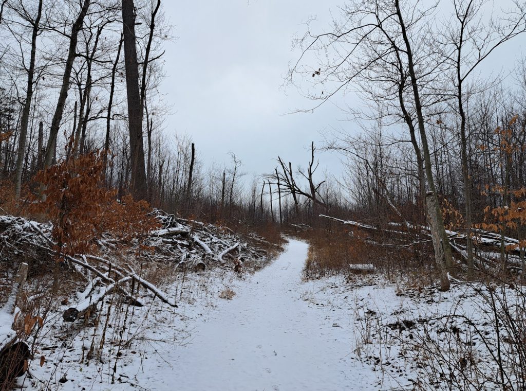
Before the bowl games of January 1st, I needed to get out and hike, and Alligator Hill in Glen Arbor won out as my first hike of the year. When I arrived, I was happy to see no footprints in the snow, so I was the first to climb these hills for 2024. I didn’t win a prize or anything, but I could count on having the place to myself.
When I entered the parking lot, I was greeted by these brick and concrete structures. These are kilns built in the 1950s by Pierce Stocking, the man the Sleeping Bear dunes drive is named after. Pierce was a lumberman and there was quite a bit of waste wood left over, and these kilns were used to produce charcoal.
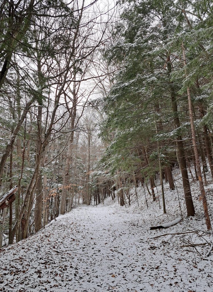
The trail soon gave me a choice, left or right. I chose right because in that direction led the advanced trail, a section of the trail I hadn’t yet hiked. I can’t claim it is any more hillier than the other trails – Alligator Hill has a lot of vertical changes – but it was stepper than most of the trail system. And it escaped most the damage of storm of eight years ago, so you will see many more tall trees.
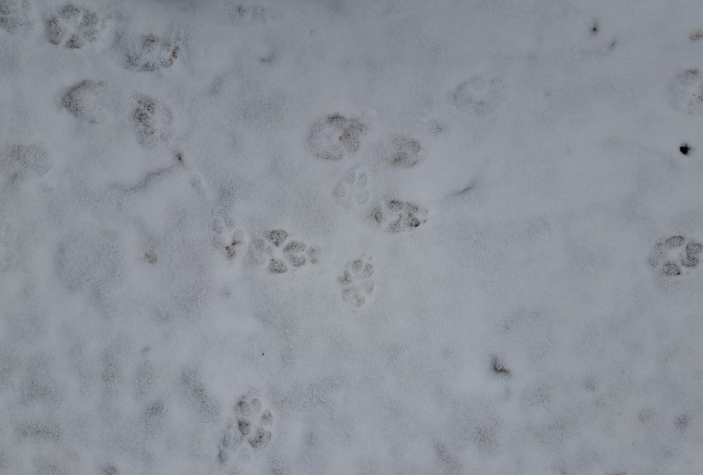
Along the way, I saw numerous animal tracks. Animal footprints are not a specialty of mine, but my best guess was a coyote. I suppose it could have been a lone dog, but I went with the coyote theory because there were no people tracks beside it.
Much of the trail still suffers from the damage of the August 2nd, 2015 windstorm that torn through the Glen Arbor area, downing many trees and damaging buildings. It will be decades before the damage is finally erased, hidden by new growth.
My first hike done, I spent the day rooting for teams that lost in the bowl games. Nothing new there. That didn’t mar the great hiking I had done earlier. And as I only hiked four miles of the 9-mile trail system, I have many more miles to look forward to.
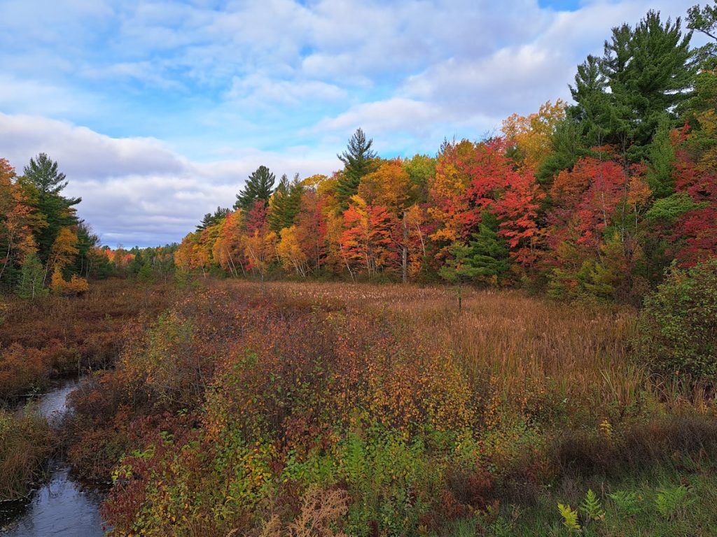
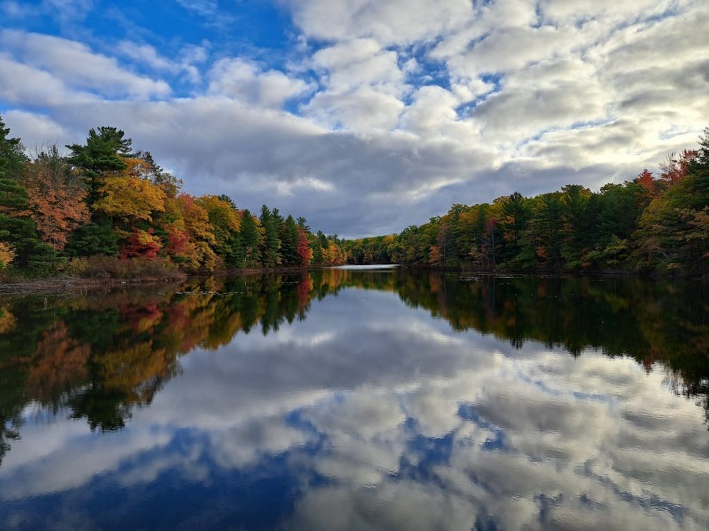
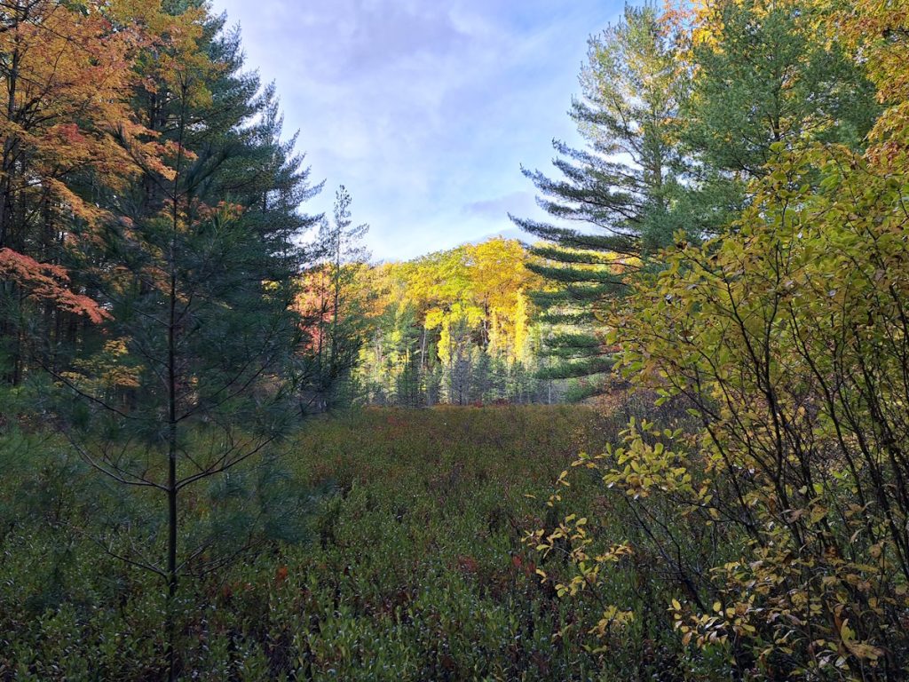
If you are a fan of fall colors, this is the time. Right now! October 22nd, 2023. Things are at their peak, and if you read this next week, you’ve missed the best of the colors and will have to wait until next year.
But in case you do, here are some photos of yesterday’s hike at Lost Lake Pathways.
Lost Lake Pathways is north of Interlochen. I’d give directions, but you have Google Maps. Or Apple Maps. Or MapQuest, if you’re still in 2005. There is a generously large dirt parking lot to begin your hiking pleasure. Or if you’re the camping sort, there is a campground. I don’t camp much – found memories of when I did – but for whatever reason, I do like wandering around empty campgrounds. And in the fall and winter, Michigan is full of them.
And what looks nicer than clouds and colorful trees and their reflections on water.
I realized as I passed the duck hunters that I needed to start wearing neon for the next several months. But I safely navigated the trails and waterways to make it back to that fabulous dirt parking lot.
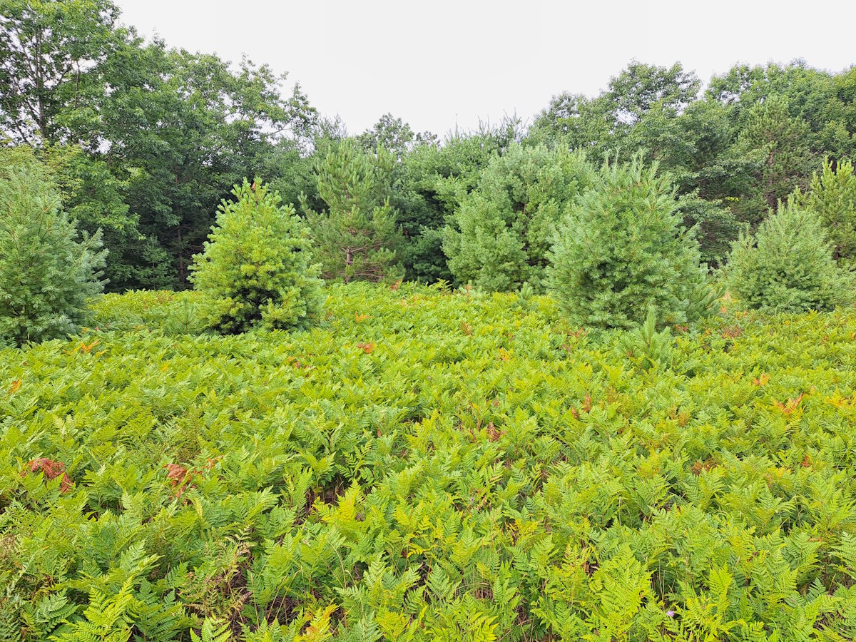
Ferns are one of those things I think of when I think of “Up North”. Sandy trails running through pine forests that end at fields of wildflowers and ferns – that is an ideal trail. My quiet morning walk at South Long Lake Nature Area was a wonderful way to start the weekend. The paths were empty and the day was cool and the late summer flora was a rich green. All too soon this will be covered with white, so I am enjoying this beautiful mornings before they hide for another year.
Happy New Year! I hope your celebration involved lots of fun whether or not it involved champagne. For you playing at home, mine did. And wine at Bluestone and Rove. And cocktails at Mammoth. It was a fun evening.
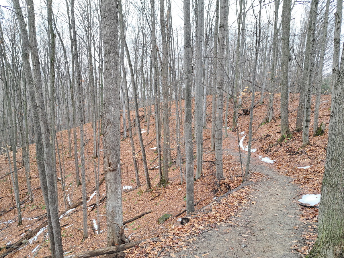
I like to hit the trails on New Year’s Day. We had company – and the day was a gray, drizzly mess – so I didn’t go for too long of a walk, but did have a shorter on at the Lake Ann Pathway. But as my office was closed to observe the holiday on the 2nd – well, a day late is better than nothing. And the day was gray and drizzly, just gray.
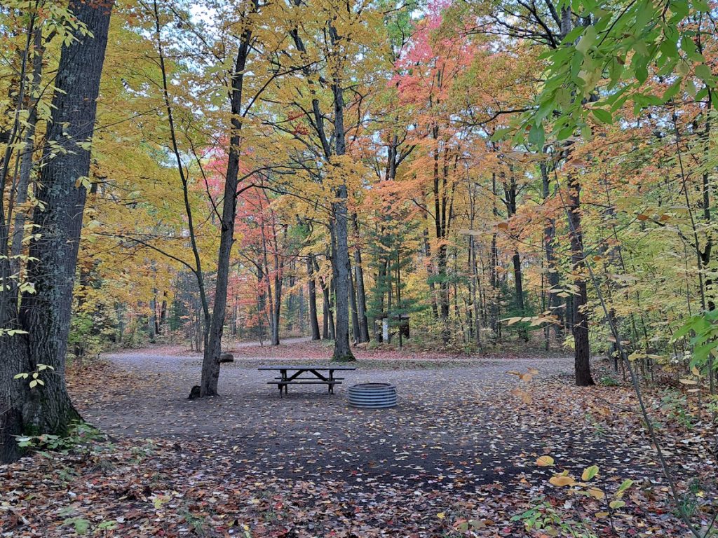
My day started quite well. It only took 15 minutes to get from my West Bay home to Acme which is almost unheard of – apparently, I wasn’t the only one with the day off. I continued my way up through Elk Rapids to Maplehurst. This trail has a special place in my heart, becoming a favorite when we spent our first five months in the Traverse City area on the East Bay and on Eighth Street. It’s a bit of a drive now from my Leelanau Peninsula house, but if I have the time, I do like to make the trip. The land was a summer camp for over 50 years before closing in 2011 and later being purchased and used as a park.
The trails were nearly empty which makes me happy – I was walking an hour before I finally saw anyone else. The big snows of a week ago (those two feet just before Christmas) were nearly gone, though the parts of the trail were a slippery mess because of all the mud. But the views of Torch Lake were still nice.
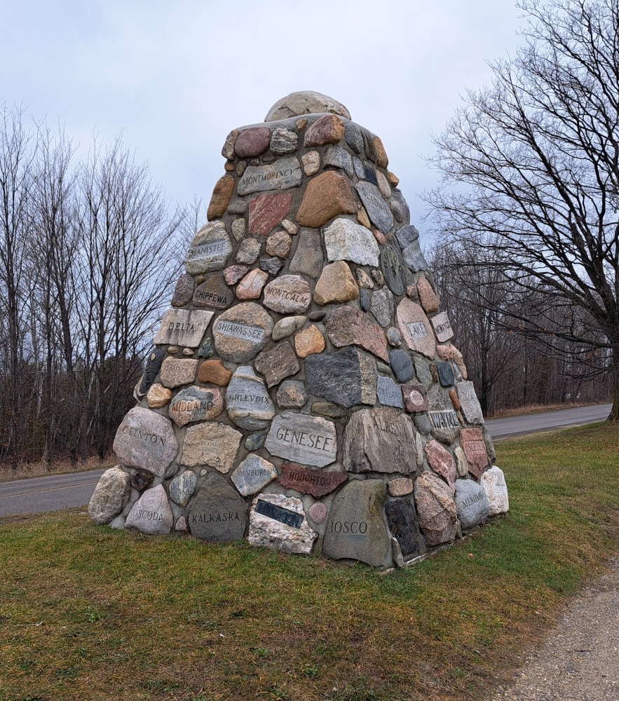
My hour-and-a-half walk concluded, I stopped by the roadside cairn on Cairn Highway, a most-appropriately named road. The cairn is made from stones from each of Michigan’s 82 counties and sits on the 45th parallel.
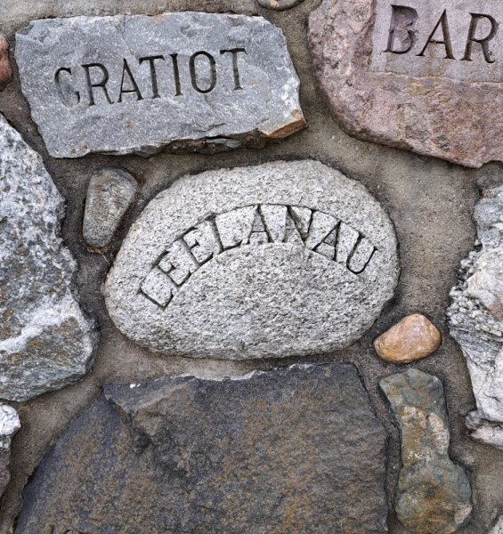
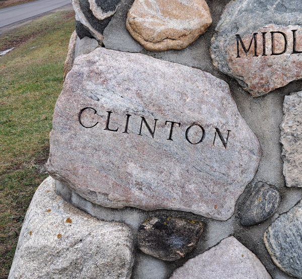
And I took pictures of the two counties I have lived, just for fun – my current one, Leelanau, and the one I lived in while in Haslett, Clinton County.
Leelanau County means “Land of Delight”. Well, it actually doesn’t. Henry Schoolcraft, who was responsible for many of the county names in Michigan, like the sound of the word and named a county after it.
Clinton County is named after DeWitt Clinton, the seventh governor of New York, and a presidential candidate. And we have a county in Michigan named after him. Go figure.
You know what places don’t have a lot of people during the winter? Beaches. They are nice places to walk, and just north of Elk Rapids is Old Bathing Beach. No, seriously – it is on Google Maps. As it was on US-31 on my way home, I stopped for a walk on the partially frozen beach for a nice view of Old Mission across the bay.
And there were these neat little ice balls floating between the beach and the frozen swells of the bay.
It was a good start to the year, and I hope I get the opportunity to go on many more.
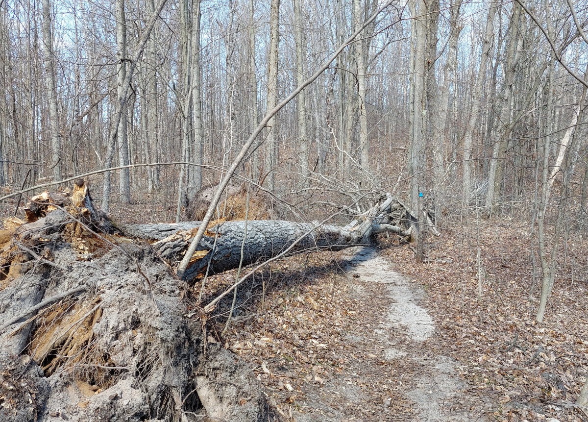
I was out on the walk at Lake Ann Pathway, minding my own business, and there was this tree in the way:
The nerve of some trees to fall on my path. But a quick detour through the woods and all was well.
I had hoped to hear some springtime frogs, and I wasn’t disappointed. Many areas near the trail are marshy, and the grumble frogs were complaining away. I don’t actually know what kind of frogs they were, but they sounded like they were complaining about something. I found a bench at a trail intersection and listened to their grumbling.
There were a handful of peepers, but still probably early for them, both the time of year and the time of day. They are more of a night frog. But we’re getting closer.
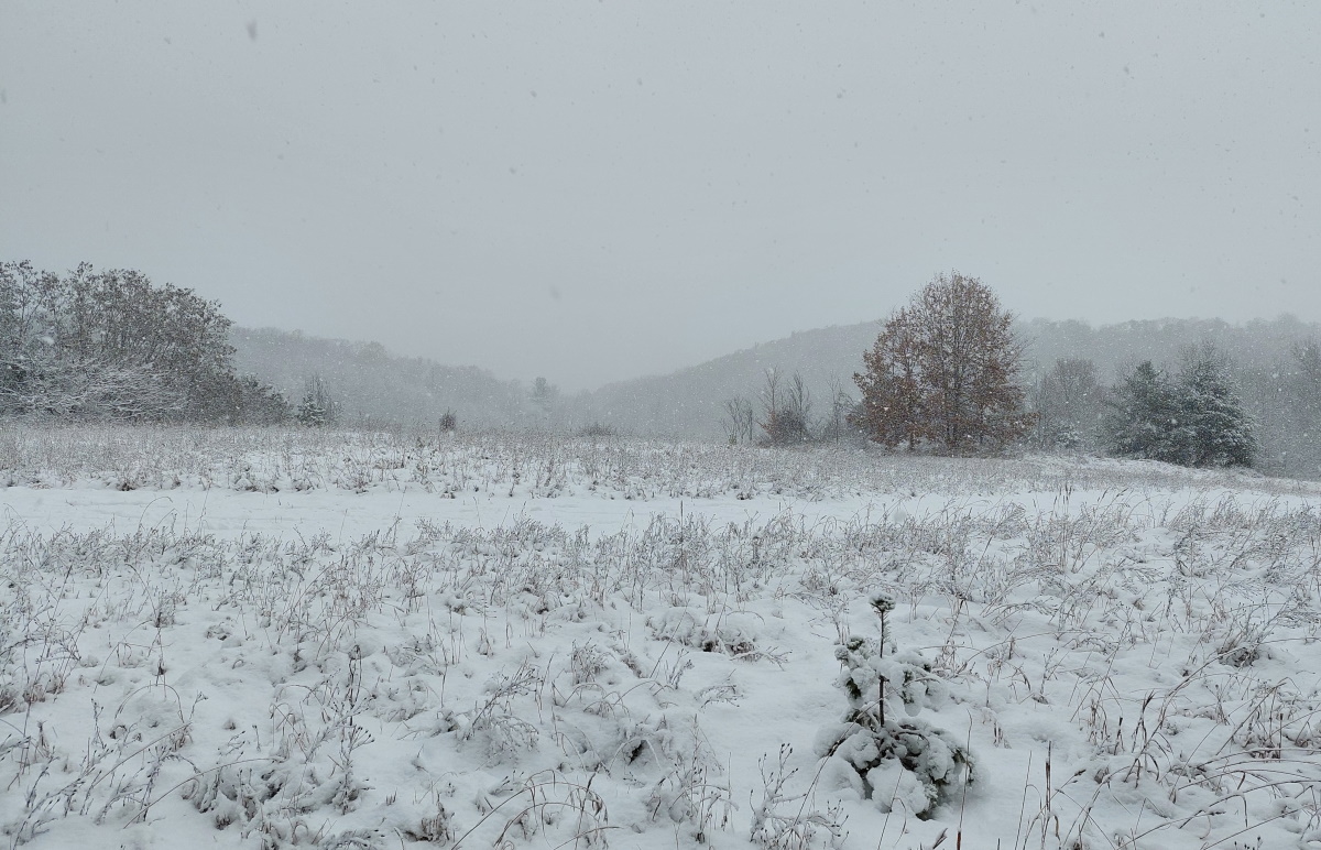
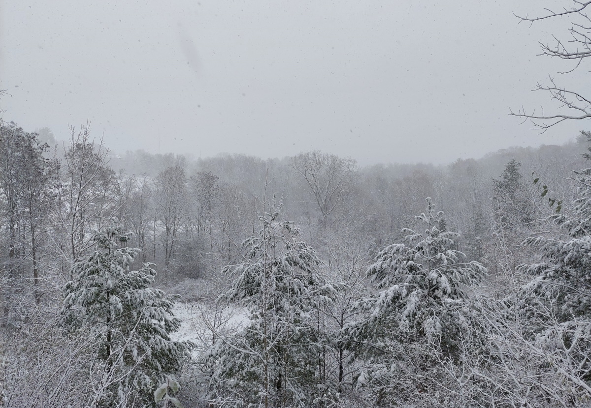
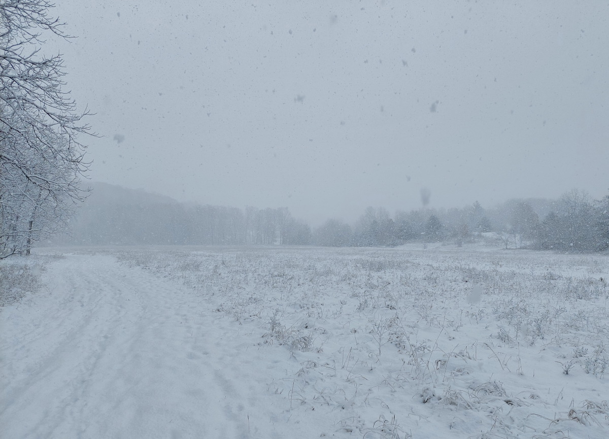
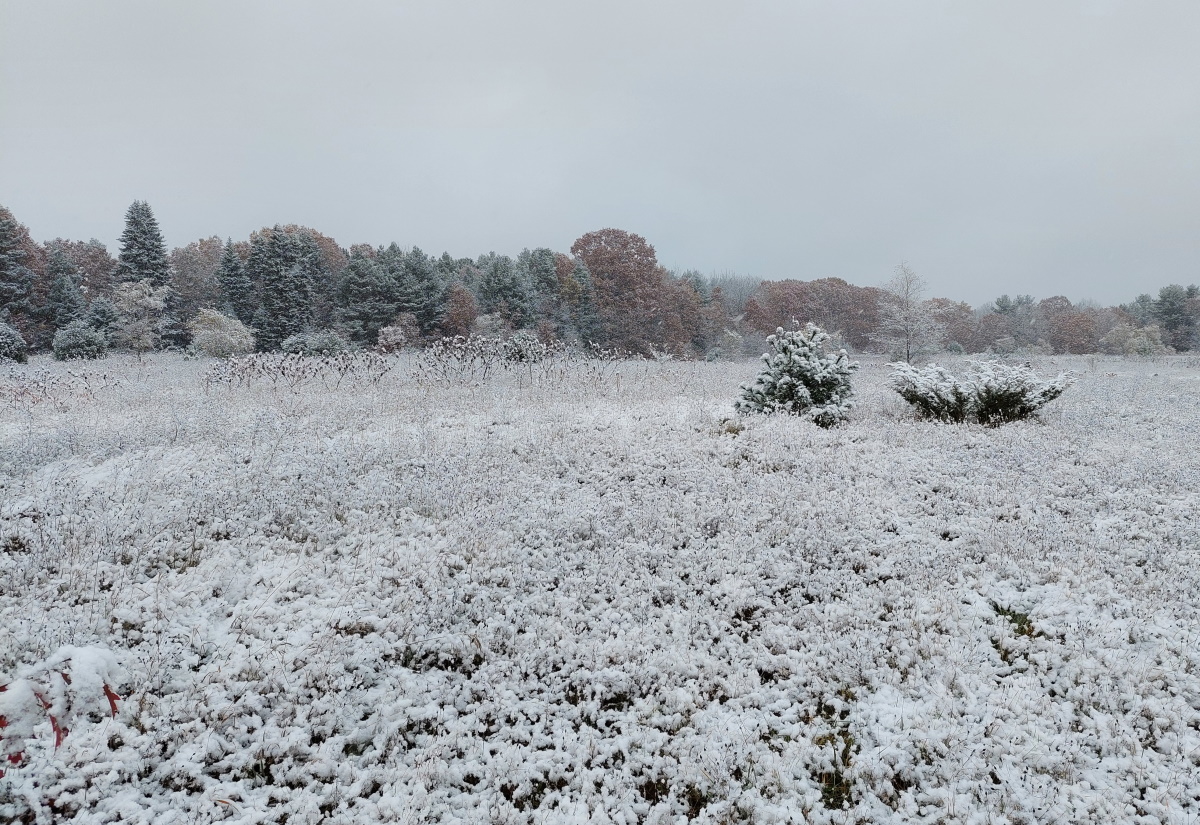
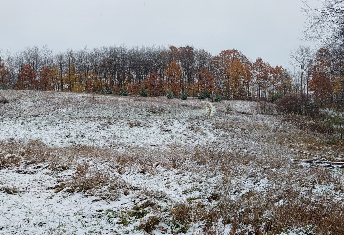
The Swedish have a saying – “There is no such thing as bad weather, only bad clothes”. I am in full agreement with that frame of mind when you live in northern Michigan. So with that, I headed the short distance to Hickory Meadows. Not many comments, just a few pictures from a snowy November day.
A few days ago, I was in this same spot and could see the West Bay and Old Mission Peninsula.
If you are looking for a safe hiking spot during hunting season, Pelizzari is a good spot, and easy to reach from downtown Traverse City. Located at the base of Old Mission, it’s probably not far from where you are staying, and hunting isn’t allowed, which isn’t the case at most trails in around the TC area.
It is also a great trail to visit when the snow is flying and you don’t want to travel too far for trail time. Only a few miles on Center Road, it will not take the plow trucks too long to reach it.
While short – only about a mile in length – Pelizzari does have multiple loops. Mainly a field walk, there are also stands of deciduous trees as well as red pines.